Cuprins
The Danube Delta is the ideal destination for a memorable holiday with your loved ones.
This unique region, with its spectacular scenery and rich biodiversity, is just a fragment of the river’s long route through Europe, mirroring diverse landscapes from vast plains to towering mountains.
The Danube River crosses 10 countries and offers a panorama of European landscapes and cultures. Because of its rich history and significant influence on the geography and economy of the regions it flows through, the Danube has become a subject of study for researchers, residents and tourists alike.
Next, we explore the most important facts about the Danube River and some fascinating facts about it.
- Where does the Danube River originate?
- Danube River Map
- Danube Route – how many capitals does the Danube pass through?
- The Danube – characteristics and importance
- The Danube spill into the Black Sea
- Curiosities about the Danube River
Where does the Danube River originate?

Where does the Danube come from is one of the most frequently asked questions about this river.
Well, the second largest river in Europe after the Volga, the Danube flows into the towering heights of the Black Forest Mountains in Germany, below the Kandel peak (1241 m).
In the park of Fürstenberg Castle in the town of Donaueschingen, the two streams, Brigach and Breg, merge their waters and set off on a journey that stretches for about 2860 km to the Black Sea.
In the middle of this landscape, at the source of the Danube River, are two impressive statues. Both represent two women, one symbolising Europe, the mother, the other the Danube itself, the daughter. It is a scene full of symbolism and emotion, the mother showing her daughter the path that awaits her.
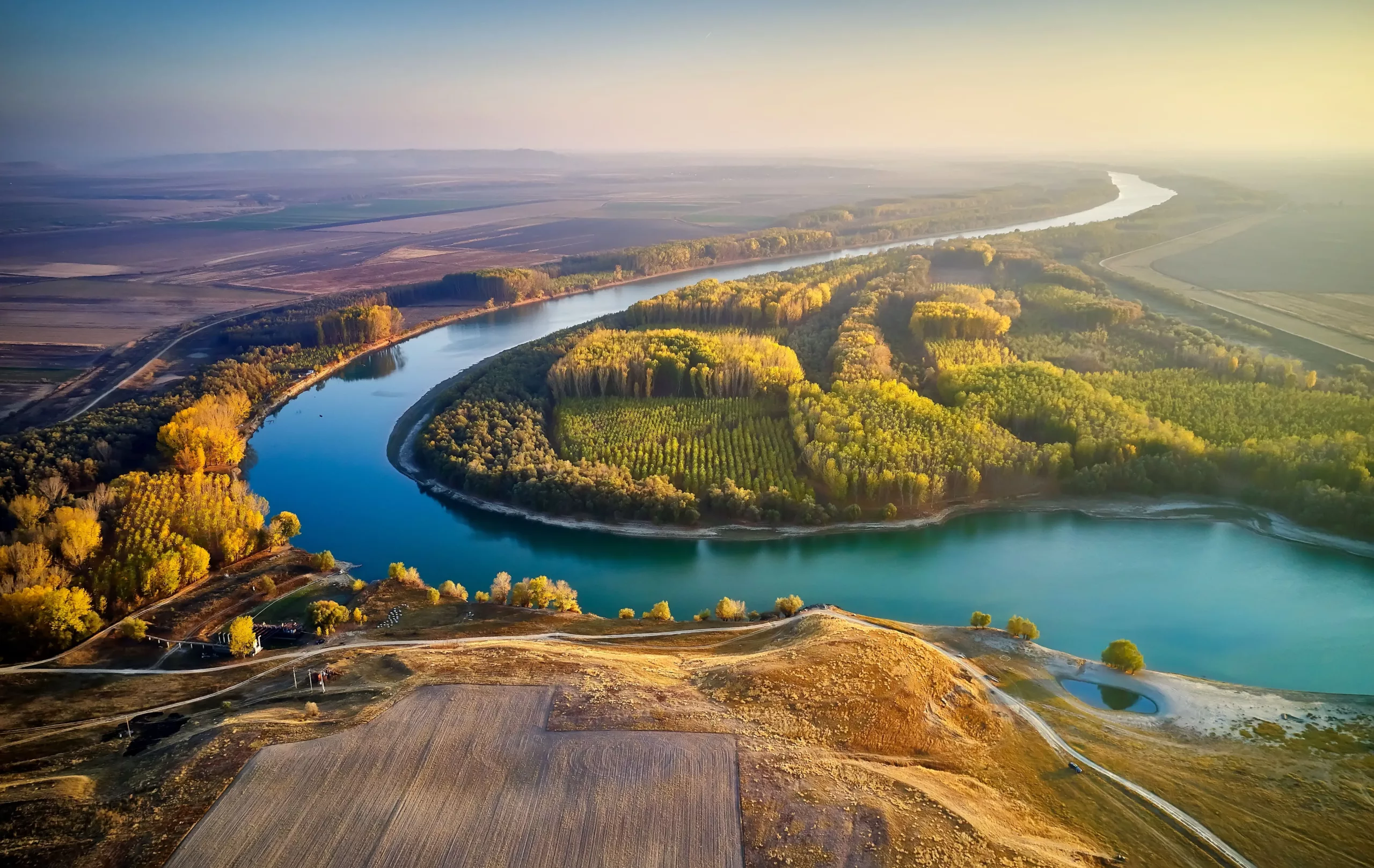
Danube River Map

The map of the Danube River illustrates its extensive route, which is why it has become one of the most important waterways in Europe.
The river is unique because of its straight course from west to east.
Danube Route – how many capitals does the Danube pass through?

The Danube flows through and connects four capitals – Vienna, Bratislava, Budapest and Belgrade – and ten European countries: Germany, Austria, Slovakia, Hungary, Croatia, Yugoslavia, Romania, Bulgaria, Moldova and Ukraine.
From the sources of the Danube to its mouth in the Black Sea, the river follows a route full of charming landscapes. Over time, the Danube has made its way through many mountain peaks of the Alpine-Carpathian system, as well as across vast plains and deltas.
The Danube – characteristics and importance

The Danube is the only river in Europe that flows from west to east and plays an important role in international transport. It has a large transport capacity, and each year it carries around 60 million tonnes of silt and 200 billion cubic metres of water.
The Danube is extremely important for navigation, fish farming and hydropower. Moreover, it is an essential source of water for people, agriculture and industry.
The course of the Danube in Romania stretches for 1075 kilometres, forming the border with Serbia, Bulgaria, the Republic of Moldova and Ukraine. In addition, along its route it collects many of the country’s rivers, with the exception of those in Dobrogea.
As the river flows through different natural regions, the lower reaches are divided into four sectors of the Danube:
- Baziaș – Porțile de Fier (Danube Gorge): the narrow area in the region of the Almăj Mountains is narrow and bears the name of “Cazane”; the construction of the dam created an extensive lake, necessary for the operation of the “Porțile de Fier” hydropower plant;
- Porțile de Fier-Călărași sector: this is located in the southern part of Romania and the Danube Plain stretches over a width of about 20-25 km;
- Călărași-Brăila sector, known as the Danube “puddles”: in this sector, the river divides into two arms that surround the Big Island of Brăila and Balta Ialomiței, which have been transformed into agricultural areas;
- The Braila-Black Sea sector, also known as the Maritime Danube: this allows access to sea vessels downstream of Braila; near Tulcea, the Danube branches into three arms: Chilia, Sulina and Sfântu Gheorghe.
Arms of the Danube

The Danube empties into the Black Sea through its arms: Chilia, Sulina and Sfântu Gheorghe. These are the three main arms, each with its own characteristics and importance. In the process, the most extensive and best preserved delta in Europe is created.
Recognised as a biosphere reserve by UNESCO, the Danube Delta is an extremely diverse ecosystem, home to a multitude of both aquatic and terrestrial life forms. Discover all about the Danube Delta: general information and curiosities.
1. Chilia Arm
The course of the river begins at the Citadel of Chilia and heads north, the northernmost arm of the Danube, stretching for about 120 kilometres, with a flow of almost 60% of the total river. The Chilia branch is an essential transport artery, supporting the economic activities of this region, along with tourism.
The Chilia arm is the largest part of the protected natural area in the Danube Delta. This area is surrounded by wilderness and is home to a vast and impressive biodiversity.
A variety of natural environments are found here – from willow and poplar forests to swamps, lakes and sandy crags. The area is also home to hundreds of bird species, where tourists can admire colonies of pelicans, egrets, cormorants, cormorants, barn owls, lizards and many other species in a beautiful natural setting.
Feast your eyes and watch the birds of the Delta! Here you can admire some 365 species, some of them rare and fascinating, for an unforgettable experience.
The water is rich in nutrients and supports the life of several aquatic species, including sturgeon and carp, helping to sustain traditional fisheries.
This stretch of the Danube is also important for commercial navigation and water transport, with a significant impact on the economy and connectivity with other European countries.
The width of the arm varies between 300 and 700 metres, and can sometimes exceed these values. Along this branch, there are areas with a single navigable channel (at the Stipoc, Chilia and Letea gullies) and areas of bifurcation between gullies.
2. Sfântu Gheorghe arm
This is the oldest arm of the Danube and runs for 112 km, heading south-east. In its course, it carries about 22% of the total volume of water and silt, and the maximum depth recorded on this arm is 26 metres.
Its navigable length has been reduced to 70 km following the cutting of six meanders, and at its mouth it forms two islands, known as the Little Sacalin and the Big Sacalin. The connection to the Razim lagoon is facilitated by two canals that branch off to the south, Dranov and Dunavat.
The scenic landscape, with extensive beaches and sand dunes, is home to a diversity of plant and animal species. Here, fishing communities live in harmony with nature, respecting traditions and contributing to the conservation of biodiversity.
Here, tourists have the opportunity to experience the authentic life of a fisherman, participate in various ecotourism activities and try the local gastronomy.
3. Sulina Arm

The central branch of the Danube, Sulina, stretches for 64 kilometres and is the shortest of the three branches. A century ago, it was regularised and channelled to facilitate the navigation of sea vessels.
It has undergone changes as a result of deepening and meander correction works, and the length of the arm has been reduced from 93 km to 64 km and the volume of water has doubled. The minimum depth of this branch of the Danube is seven metres and the maximum depth is 28 metres.
When it flows into the Black Sea, the silt settles fairly quickly because the fresh waters of the river interact with the salty waters of the sea. This has led to the formation of the Sulina bar, which can block the mouth of the river.
To reduce this effect, a 10 km long dike was built to remove the silt carried by the sea’s circular currents. The Sulina arm is subject to continuous dredging to ensure navigability for sea-going vessels.
This branch of the Danube River is the main navigable route to the Black Sea and is a vital corridor for European river trade, having been modernised to support international trade connections, but it also preserves natural elements essential for the biodiversity of the Delta.
In addition to its three main branches, the Danube River is divided into:
- The Borcea and Ostrov arms, which form near Siliștea;
- The Old Danube arm, which is formed downstream of Giurgeni;
- The Vâlciu arm is the most important of the western arms and delimits the Balta Brăilei;
- The Calia arm is formed near the village of Gura Gârluței.
The Danube spill into the Black Sea

The Danube spill into the Black Sea is a natural phenomenon that has a significant ecological impact. At the time of the spill, the fresh waters of the Danube mix with the salty waters of the sea, creating unique living conditions for many marine species.
The nutrients that the Danube deposits support phytoplankton and feed the entire marine food chain.
In addition, the sediments carried by the river shape beaches and sandbanks, creating nesting and breeding grounds for birds and fish.
This process is vital for both fisheries and tourism, contributing to the conservation of biodiversity and the prosperity of coastal communities.
Explore images of the Danube and enjoy memorable experiences in the Danube Delta. Choose the right accommodation for you and your family and connect with nature!
Curiosities about the Danube River

Over the years, many curiosities have arisen about the Danube. Here are the most popular ones:
- What country does the Danube originate from?
The Danube River flows from Germany.
- Where does the Danube flow?
The Danube River flows into the Black Sea, where it forms the Danube Delta.
- What are the main tributaries of the Danube?
The main tributaries of this river are Iller, Gunz, Sava, Tisa, Morava, Drava, Inn, Cerna, Jiu, Olt, Vedea, Argeș, Ialomița, Siret, Prut.
- How deep is the Danube?
The average depth of the Danube River varies between 70 m and 80 m.
- How wide is the Danube?
The width of the Danube varies depending on where it passes through. In general, in navigable sections, its width can range from a few hundred metres to a kilometre or more.
- How many kilometres is the Danube?
The river has a total length of 2860 km, and if you look at the map of the Danube in Romania, you will see that it runs for 1075 km.
Other curiosities about the Danube in Romania:
- transports on average around 30 million tonnes of silt per year;
- gathers almost the entire hydrographic network of our country;
- has more than 300 tributaries, 96 of which are in our country;
- the highest flows are recorded in May and the lowest in autumn and winter;
- Its hydropower potential represents about a quarter of our country’s total hydropower potential.
Therefore, since the Danube entered Romania, this river has been an important resource for our country.
Through its geographical diversity and ecological importance, the Danube supports both the economy and tourism. That is why it is important to protect and preserve the Danube River, ensuring that future generations will also benefit from it.
Photo sources: Shutterstock, Shutterstock, Shutterstock, Shutterstock, Shutterstock, Shutterstock, Shutterstock, Shutterstock